Latehar district is a naturally rich and culturally vibrant district in the state of Jharkhand. It lies in the western part of the state and forms an important segment of the Palamu division. Moreover, Latehar is widely known for its forests, mineral resources, and tribal heritage. As a result, it attracts nature lovers, researchers, and development planners alike. Although the district has a strong rural base, it continues to grow steadily with infrastructure development and government initiatives. Consequently, Latehar stands out as a district that blends natural beauty, cultural diversity, and economic potential.
Latehar District Quick Overview
| Particulars | Details |
| District Name | Latehar |
| State | Jharkhand |
| Headquarters | Latehar |
| Region | Palamu Division |
| Known For | Forests, minerals, wildlife |
| Official Language | Hindi |
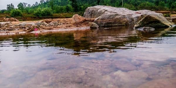
| Major Rivers | North Koel |
| Economy | Agriculture, mining, forestry |
Historical Background of Latehar District
Latehar district has a rich historical background rooted in tribal traditions and regional governance. Earlier, the region formed part of the larger Palamu district. Therefore, it shared administrative and cultural ties with surrounding areas.
During medieval times, local rulers governed the region and contributed to its development. Later, under British rule, administrative systems expanded, and resource management became a priority. Consequently, the region gained importance for its forests and minerals.
After independence, Latehar became a separate district in 2001 following the formation of Jharkhand. Therefore, it evolved into a modern administrative unit while preserving its traditional identity.
Geography and Location
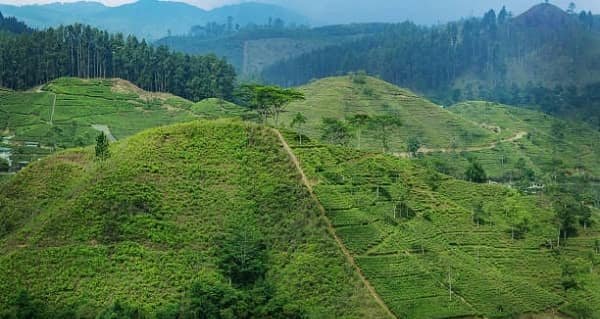
Latehar district lies in the western part of Jharkhand. It features forests, hills, and river valleys.
Key Geographic Features:
- Located in the Chotanagpur Plateau
- Dense forest cover
- North Koel River flows through the district
- Moderate climate with seasonal rainfall
Because of its geography, the district supports biodiversity and agriculture. Moreover, forests enhance ecological importance. Therefore, Latehar holds environmental significance.
Administrative Structure
Latehar district follows a structured administrative system.
Administrative Highlights:
- Deputy Commissioner oversees governance
- Divided into blocks and subdivisions
- Municipal bodies manage urban areas
- Panchayats govern rural regions
Consequently, governance ensures effective delivery of public services and development programs.
Economy of Latehar District
The economy of Latehar is diverse. It includes agriculture, mining, and forest-based activities.
Major Economic Activities:
- Agriculture
- Mining (coal and minerals)
- Forest produce collection
- Livestock farming
Because of mineral resources, mining plays a significant role in the economy. Moreover, agriculture supports rural livelihoods. Therefore, Latehar has a mixed economic structure.
Mining and Industrial Activities
Latehar district has significant mineral resources.
Key Features:
- Coal mining
- Mineral extraction
- Industrial potential
Because of these resources, the district contributes to Jharkhand’s industrial sector. However, sustainable practices remain important.
Agriculture in Latehar
Agriculture forms the backbone of the rural economy.
Key Crops:
- Paddy (rice)
- Maize
- Pulses
- Oilseeds
Additionally, rainfall supports farming activities. Consequently, agriculture sustains a large population.
Forest Resources and Wildlife
Latehar has extensive forest cover and wildlife.
Key Features:
- Timber and minor forest produce
- Rich biodiversity
- Protected forest areas
Because of these resources, forestry plays an important role in the economy and environment.
Tourism in Latehar District
Latehar district offers several natural and wildlife attractions. Therefore, it attracts tourists seeking nature and adventure.
Major Tourist Attractions:
- Betla National Park: Famous wildlife sanctuary
- Netarhat: Known as the “Queen of Chotanagpur”
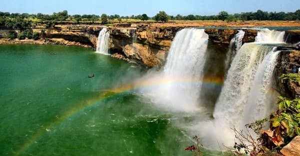
- Lodh Waterfall: Highest waterfall in Jharkhand
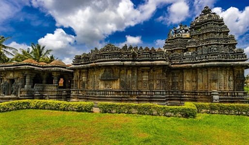
- Palamu Fort: Historic site
Because of these attractions, tourism contributes to the district’s economy. Moreover, eco-tourism continues to grow.
Connectivity and Transport
Latehar district has improving connectivity.
Transport Options:
- Road: Connected via state highways
- Rail: Latehar railway station connects nearby regions
- Air: Nearest airport is Birsa Munda Airport
Because of these options, travel remains manageable. Consequently, connectivity continues to improve.
Education and Infrastructure
Latehar has improved its infrastructure over time.
Facilities Include:
- Schools and colleges
- Healthcare centers
- Banking and financial services
- Road networks
Moreover, government initiatives continue to enhance facilities. Therefore, the district shows steady progress.
Culture and Lifestyle
Latehar reflects rich tribal culture and traditions. Therefore, diversity plays an important role.
Cultural Highlights:
- Hindi and tribal languages are spoken
- Festivals like Sarhul and Karma are celebrated
- Traditional music and dance
- Community-based lifestyle
Consequently, the district maintains a vibrant cultural identity.
Challenges Faced by Latehar District
Despite development, Latehar faces several challenges.
Key Challenges:
- Limited infrastructure in remote areas
- Dependence on agriculture
- Environmental concerns due to mining
- Employment opportunities
However, government initiatives aim to address these issues. Therefore, development continues steadily.
Future Development Prospects
Latehar shows strong potential for growth. Therefore, future development may focus on:
- Promoting eco-tourism
- Improving infrastructure
- Supporting sustainable mining
- Enhancing agricultural productivity
Consequently, the district may achieve balanced development.
Final Words
Latehar district combines natural beauty, mineral wealth, and cultural richness. It plays a vital role in Jharkhand’s economy and ecology. Moreover, its forests, wildlife, and traditions make it unique. Therefore, Latehar continues to grow while preserving its identity. With improved infrastructure and sustainable development, it holds strong potential for the future.
FAQs
Q: Where is Latehar district located?
A: It is located in western Jharkhand.
Q: What is Latehar famous for?
A: It is known for forests, wildlife, and mineral resources.
Q: Which river flows through Latehar?
A: The North Koel River flows through the district.
Q: What crops are grown in Latehar?
A: Paddy, maize, pulses, and oilseeds are commonly grown.
Q: Is Latehar a tourist destination?
A: Yes, it offers wildlife parks and scenic locations.
Q: How can I reach Latehar?
A: You can travel by road, rail, or via Ranchi airport.
Q: Which languages are spoken in Latehar?
A: Hindi and tribal languages are widely spoken.
Q: What are the main economic activities?
A: Agriculture, mining, forestry, and tourism.