Nandurbar district is a significant tribal and agricultural district in the northwestern part of Maharashtra. It lies near the borders of Gujarat and Madhya Pradesh. Therefore, it holds strategic importance in terms of location and connectivity. Moreover, the district is known for its tribal culture, natural landscapes, and agricultural activities. As a result, it attracts researchers, cultural enthusiasts, and eco-tourists. Although Nandurbar remains largely rural and underdeveloped compared to urban districts, it continues to progress steadily. Consequently, it plays an important role in Maharashtra’s socio-cultural and agricultural framework.
| Particulars | Details |
| District Name | Nandurbar |
| State | Maharashtra |
| Headquarters | Nandurbar |
| Region | Northwestern Maharashtra |
| Borders | Gujarat, Madhya Pradesh |
| Official Language | Marathi |
| Known For | Tribal culture, agriculture |
| Economy | Farming and forestry |
Historical Background of Nandurbar District
Nandurbar district has a rich historical background shaped by tribal traditions and regional influences. Earlier, it formed part of the Dhule district. However, administrative reorganization in 1998 led to the creation of Nandurbar as a separate district.
Historically, the region came under various rulers, including local tribal chiefs and later the Maratha Empire. Therefore, it developed a unique blend of tribal and mainstream cultural elements.
During British rule, the district remained part of larger administrative units. Consequently, development remained limited. After independence, Nandurbar gained recognition as a distinct tribal region.
Geography and Location
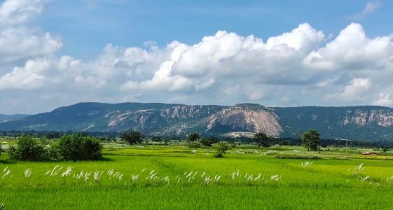
Nandurbar district lies in the northwestern corner of Maharashtra. It features a mix of hills, forests, and plains.
Key Geographic Features:
- Satpura mountain ranges
- Tapi River flows through the district
- Forested and hilly terrain
- Semi-arid climate
Because of its geography, the district supports both agriculture and forestry. Moreover, the hilly terrain influences settlement patterns. Therefore, Nandurbar has a distinct natural environment.
Administrative Structure
Nandurbar district follows a structured administrative system.
Administrative Highlights:
- District Collector leads governance
- Divided into taluks such as Nandurbar, Shahada, Taloda, Navapur, and Akkalkuwa
- Municipal bodies manage urban areas
- Panchayats govern rural regions
Consequently, governance ensures effective delivery of public services.
Economy of Nandurbar District
The economy of Nandurbar mainly depends on agriculture and forest resources. However, small-scale industries also contribute.
Major Economic Activities:
- Agriculture
- Forestry and forest produce
- Animal husbandry
- Small-scale trade
Because of fertile patches and river systems, farming remains the primary occupation. Moreover, forest resources support livelihoods. Therefore, the district maintains a rural economy.
Agriculture in Nandurbar
Agriculture plays a key role in the district’s economy.
Key Crops:
- Jowar (sorghum)
- Bajra (pearl millet)
- Cotton
- Maize
- Pulses
Additionally, irrigation from the Tapi River supports farming. Consequently, agricultural productivity remains stable in irrigated areas.
Tribal Culture and Lifestyle
Nandurbar is known for its tribal population. Therefore, it reflects unique cultural traditions.
Cultural Highlights:
- Tribal communities like Bhil and Pawara
- Traditional dances and festivals
- Distinct art and crafts
- Strong community-based lifestyle
Consequently, the district preserves its cultural heritage.
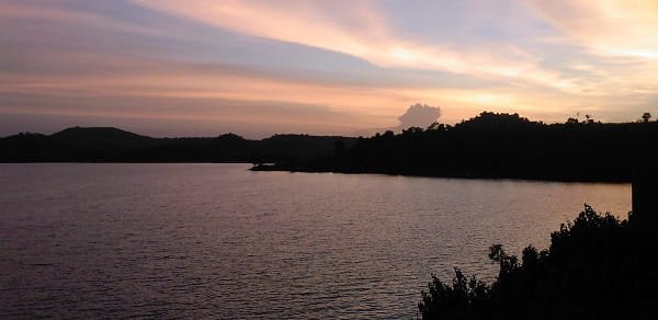
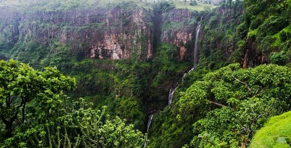
Tourism in Nandurbar District
Nandurbar offers natural and cultural attractions. Therefore, it has potential for eco-tourism.
Major Tourist Attractions:
- Torana Mal Hill Station: Scenic hill destination
- Unapdev Hot Water Springs: Natural hot springs
- Akkalkuwa region: Known for tribal culture and nature
Because of these attractions, the district attracts visitors seeking nature and peace.
Connectivity and Transport
Nandurbar district has moderate connectivity.
Transport Options:
- Road: Connected through state highways
- Rail: Nandurbar railway station connects major cities
- Air: Nearest airport is Surat Airport
Because of these options, travel remains manageable. Consequently, connectivity continues to improve.
Education and Infrastructure
Nandurbar has improved its infrastructure gradually.
Facilities Include:
- Schools and colleges
- Government hospitals
- Banking and financial services
- Road networks
Moreover, development programs aim to enhance facilities. Therefore, the district shows gradual progress.
Challenges Faced by Nandurbar District
Despite development, Nandurbar faces several challenges.
Key Challenges:
- Tribal poverty
- Limited industrial development
- Infrastructure gaps
- Education and healthcare issues
However, government initiatives aim to address these issues. Therefore, development continues steadily.
Future Development Prospects
Nandurbar shows strong potential for growth. Therefore, future development may focus on:
- Tribal welfare programs
- Agricultural improvement
- Infrastructure development
- Promoting eco-tourism
Consequently, the district may achieve balanced development in the future.
Final Words
Nandurbar district combines natural beauty, tribal heritage, and agricultural strength. It plays an important role in Maharashtra’s cultural and rural development. Moreover, its unique traditions and landscapes make it special. Therefore, Nandurbar continues to grow steadily while preserving its identity. With improved infrastructure and focused development efforts, it holds strong potential for the future.
FAQs
Q: Where is Nandurbar district located?
A: It is located in northwestern Maharashtra near Gujarat and Madhya Pradesh.
Q: What is Nandurbar famous for?
A: It is known for tribal culture, agriculture, and natural attractions.
Q: Which crops are grown in Nandurbar?
A: Jowar, bajra, cotton, maize, and pulses are commonly grown.
Q: Is Nandurbar a tourist destination?
A: It offers eco-tourism spots like hill stations and hot springs.
Q: How can I reach Nandurbar?
A: You can travel by road, rail, or via Surat Airport.
Q: Which language is spoken in Nandurbar?
A: Marathi is the primary language.
Q: What are the main economic activities?
A: Agriculture, forestry, animal husbandry, and trade.
Q: What challenges does Nandurbar face?
A: Poverty, infrastructure gaps, and limited industrialization.